
Columbia ZIP Code Directory Coverage
Columbia is in Boone County, and its postal working set is broader than the three familiar delivery areas. The Census Columbia profile identifies ZCTA context for 65201, 65202, 65203, 65215, and 65216. The broader research list also captures special, institutional, and post-office ZIPs that appear in official Columbia addresses. A ZCTA is a Census approximation. It is not a legal boundary and does not replace a live Postal Service result for a specific address.
| ZIP Code | Areas Covered | Post Office | Notes |
|---|---|---|---|
| 65201 | Central and east Columbia, downtown, older core, and nearby delivery area | Columbia USPS delivery area | Map against city limits, not the ZIP alone |
| 65202 | North and northeast Columbia with county-edge delivery areas | Columbia USPS delivery area | Includes Paris Road and other north or east corridors |
| 65203 | South and west Columbia with southwest delivery area | Columbia USPS delivery area | Includes West Broadway and southwest corridors |
| 65205, 65212 | Columbia post-office or special mailing context | Columbia mailing designation | Verify each address, not a parcel neighborhood |
| 65211, 65215-65218, 65299 | Institutional or special mailing context | Columbia special route | Do not infer a parcel or exact route without USPS confirmation |
The USPS ZIP Code Lookup is the launch authority for a street address, city and state, or ZIP-to-city check. The research could not verify a live Columbia result through the site's blocked city-and-state response, so it does not assign exact station boundaries or special-route functions here.
Run the address through USPS before using a ZIP as a filter or note in any local record search. The returned ZIP confirms delivery formatting, not a person or organization at that address.
USPS Delivery Areas Behind Columbia ZIP Codes
USPS ZIPs serve delivery routes and postal facilities. Columbia city limits serve a different purpose. A Columbia ZIP code directory can organize the postal terms, but it cannot turn them into municipal boundaries. A mailing address can say Columbia while covering unincorporated Boone County, and a city parcel may have a ZIP associated with a special route, post office, or institutional delivery context. The City limits changed through annexations, while postal boundaries can change on a different timetable. A ZIP label therefore should never decide whether a record belongs inside the City of Columbia.
For geographic context, consult the Census Columbia profile for its ZCTA reference, then test the address against an official local map. Postal geography and Census geography each provide context, but the actual address result and parcel location do the deciding.
Columbia ZIP Code Context in 65201 to 65203
The core ZIPs are useful starting points, not hard-edged neighborhood lines. Research ties 65201 to central and east Columbia, including the downtown and older core. It ties 65202 to north and northeast delivery areas, with Paris Road and county-edge context, while 65203 covers south and west Columbia and includes West Broadway and southwest corridors. Those corridor examples help orient a search but do not turn a ZIP into a ward, precinct, neighborhood, or city-limit line.
Use the Boone County Clerk map index for road, precinct, ward, civil-township, and city-limit context. It is more useful than a postal label when the question is jurisdiction or local-record coverage.
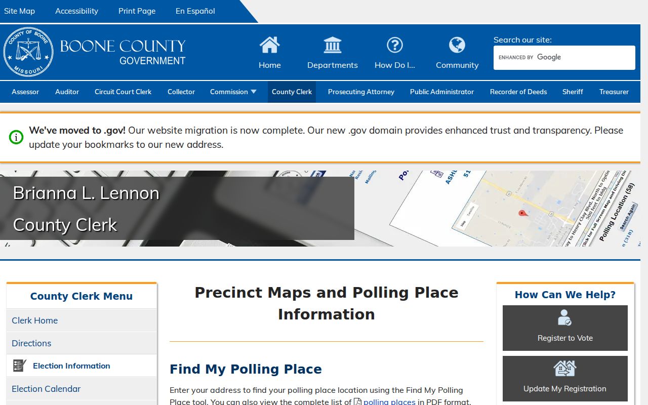
The county map index helps compare a street with city limits and local districts after USPS confirms the mailing ZIP. It does not publish a definitive USPS ZIP boundary map.
Columbia Special ZIP Codes Need Address Checks
Special ZIPs are an uncertainty, not a shortcut. The research list includes 65205, 65211, 65212, 65215, 65216, 65217, 65218, and 65299 alongside the core delivery areas. Official Columbia university and agency addresses use 65211, while 65205 and 65212 occur in post-office or special mailing contexts. The Census context includes 65215 and 65216, but it does not prove an exact route, a unique institution, or a physical parcel for every address using either ZIP.
- ZIP Code
- A Postal Service delivery code used to route mail, not a municipal boundary.
- ZIP+4
- An added four-digit segment that narrows a delivery point or small delivery grouping within a ZIP.
- PO-box ZIP
- A ZIP used for post-office box or special mailing service; it does not identify a street parcel.
- Unique ZIP
- A ZIP associated with a particular delivery arrangement. Confirm the current use with USPS before describing it that way.
- Carrier route
- A mail-delivery grouping within postal operations, not a public roll of everyone at the addresses.
Preserve an historical address as printed. Add a modern ZIP only as a separately verified field, especially when comparing older directories with a present-day parcel map.
Finding Columbia Residents by ZIP Code
A ZIP-first process has to begin with an address, not a claim that a whole ZIP identifies every person. USPS can verify the address format. Boone parcel tools and CityView can then establish parcel and jurisdiction context. Local record systems usually search by name, street, parcel, or date rather than by ZIP. Once a result displays an address, compare its printed ZIP with the Postal Service result and note the record date.
- Enter the complete street address in USPS ZIP Code Lookup and save the returned delivery format.
- Use the Boone Assessor or parcel viewer to search the street, house number, or parcel and identify the situs location.
- Open CityView or a County Clerk map to compare city limits, wards, precincts, roads, or annexation context.
- Use a permitted record search for its actual fields, then compare the returned address and date with USPS verification.
- When the question becomes a specific street, continue with the Columbia street directory for the address-keyed workflow.
Boone's voter confirmation search is name and date-of-birth based, not a ZIP roster. Missouri law allows some voter information subject to release rules and protected-address restrictions, but the public Boone tool is not designed to list people by ZIP.
Where Columbia Portals Show a ZIP Code
Several local tools print a ZIP in an address result, but the inspected interfaces do not expose a true ZIP-only search. The Columbia ZIP code directory therefore starts with USPS confirmation and then uses the actual portal fields. That distinction prevents wasted searching and helps explain why a county map or USPS result may be needed first. The portal fields below are the recorded, public interface choices from the local research.
| Portal | Fields or filter | How ZIP appears | Search limit |
|---|---|---|---|
| USPS ZIP Lookup | Street address, city/state, or ZIP-to-city mode | Delivery result | Verification authority for a specific address |
| Boone Assessor Address Search | Street name, house number, suffix, direction | Read returned mailing or situs ZIP | No ZIP field was exposed |
| City permit data | Start date, end date, work class | Printed in result address | No ZIP filter was exposed |
| Boone Parcel GIS | Address, owner, or parcel search | May appear in address result | No ZIP filter was visible |
| Boone voter lookup | Last name, first name, date of birth | Not an open ZIP search field | Confirmation tool, not a ZIP roster |
The Boone Assessor Address Search and City permit data search are useful only after moving from the ZIP to a street, a parcel, or a dated address result. The Assessor does not expose a ZIP field, and the permit search exposes dates and work class rather than a ZIP filter.
ZIP Code Boundaries and Columbia City Limits
For a city-limit question, use mapping data, not a postal assumption. CityView brings together streets, addresses, property, political jurisdiction, wards, utility-service context, and annexation history. Its parcel ownership and appraisal data come from Boone Assessor. The Boone parcel viewer supplies owner, address, parcel, aerial, terrain, and Identify tools. Together they provide the local bridge between a delivery ZIP and the physical location used in county and city records.
The CityView layer inventory explains the available municipal context. A parcel can sit in a Columbia delivery area while lying outside the city line, so use the address result, parcel geometry, and the applicable map layer before calling a record municipal.
Columbia Annexation and Map-Layer Context
Columbia's annexation history reaches 67.776 square miles in the City's table through 2022. The local research also records a proposed September 2026 hearing for 1.68 acres east of Rock Quarry Road and south of Scarborough Drive. It was pending at the research date, not an effective change. That example shows why postal, ward, and city-boundary terms require a date as well as an address.
CityView's annexation layer, the Boone civil-township and road maps, and the parcel viewer give the needed context. A boundary may change while the ZIP stays familiar, or an address may remain in a Columbia postal area before it enters the city. For historical work, preserve the town or street wording printed in the original record before applying current map context.
A ZIP Code Is Not a Columbia Household List
A ZIP can assist with mail verification and rough search organization, but it cannot reliably identify people at every address. Assessor records distinguish physical situs and mailing addresses. A tax-roll owner can be a trust, estate, public body, company, or an owner whose tax notice goes somewhere else. Voter records have separate statutory protections, and Safe at Home participants may use a substitute address. Private utility accounts, delivery records, and motor-vehicle information are not public ZIP tools.
Use records for lawful personal research, family history, civic context, or an address question, and do not use them to stalk, harass, or harm anyone. A missing match may reflect a protected address, a different record date, a mailing-versus-situs difference, or a system that simply does not search by ZIP.